Very Toronto
NewsEatsBlogEventsBest OfNew & Hot
Best of Toronto

The Best Hiking Trails Near Toronto

Ravine walks you can reach by TTC, escarpment lookouts an hour away, and a national park inside city limits. The best hikes in and around Toronto.

Updated recently8 Destinations
No.1
Rouge National Urban Park
RecreationScarborough

Rouge National Urban Park

This is a legitimate national park hike that you can reach by city bus — the Glen Eagles Vista bluff with 20,000-year-old rock layers feels absurdly underappreciated.

— Very Toronto Editors

Canada's first and only national urban park, this vast green space offers a unique blend of forests, creeks, farms, marshland, and a beach on Lake Ontario, providing a true wilderness experience within the city.

No.2
Dundas Peak & Tew's Falls
RecreationHamilton (1 hr drive)

Dundas Peak & Tew's Falls

The five-minute walk from parking to Tew's Falls is the best effort-to-payoff ratio of any hike in the region — the Peak is the Instagram shot every Torontonian eventually posts.

— Very Toronto Editors

A 2.9 km loop on the Niagara Escarpment featuring Tew's Falls (a 41-metre waterfall) and the dramatic Dundas Peak lookout over the Spencer Gorge. Moderate difficulty, 1-1.5 hours. Reservations required.

No.3
Forks of the Credit Provincial Park
RecreationCaledon (1 hr drive)

Forks of the Credit Provincial Park

Peak fall colour season here is the most beautiful day hike within striking distance of the city — arrive at opening on an October Saturday or don't bother, the lot fills fast.

— Very Toronto Editors

Forks of the Credit Provincial Park is a rugged, 282-hectare slice of the Niagara Escarpment that feels worlds away from the GTA despite being only an hour’s drive north. Established in 1985, this park is defined by the dramatic geology of the Credit River valley, where glacial activity left behind distinct features like a kettle lake and a steep talus slope. It carries a fascinating industrial history; the area was once a hub for sandstone quarrying—the very stone used to build Toronto’s Old City Hall and Queen’s Park—and the ruins of a historic mill and powerhouse still stand as quiet reminders of the river’s former role in powering the local economy. The atmosphere is raw and unmanicured, offering a genuine escape into hardwood forests and open meadows that change beautifully with the seasons. For a first-timer, the 10 km loop is the standard way to experience the park, but be prepared for moderate elevation changes that will get your heart rate up. You absolutely must pack your own water and snacks, as there are no facilities within the park to purchase supplies. Because parking is strictly limited and the park is incredibly popular, you are required to book a daily vehicle permit online in advance; do not show up without one, as you will be turned away. The best time to visit is during the shoulder seasons or on a weekday to avoid the heavy weekend crowds. If you are looking for a quieter experience, aim for a winter hike or snowshoeing session when the gorge takes on a serene, frozen beauty.

No.4
Rattlesnake Point — Nassagaweya Trail
RecreationMilton (45 min drive)

Rattlesnake Point — Nassagaweya Trail

The ancient cedars clinging to the escarpment edge are older than the city of Toronto itself — Crawford Lake's perfectly still, layered water at the end feels like a reward you earned.

— Very Toronto Editors

A 14.4 km round trip from the Niagara Escarpment cliffs at Rattlesnake Point to Crawford Lake, a rare meromictic lake. Passes 800-year-old cedars and dramatic cliff-edge lookouts. Moderate to difficult, 4-5 hours.

No.5
Tommy Thompson Park (Leslie Street Spit)
RecreationPort Lands

Tommy Thompson Park (Leslie Street Spit)

Walking to the lighthouse at the tip and looking back at the entire Toronto skyline is the closest thing the city has to an out-of-body experience.

— Very Toronto Editors

An 18 km trail network on a constructed landform extending 5 km into Lake Ontario. Flat paths through wildflower meadows, cottonwood forests, and coastal marshes. Easy difficulty, 2-4 hours. Over 300 bird species recorded.

No.6
Scarborough Bluffs Trail
RecreationScarborough

Scarborough Bluffs Trail

People who've never been to the Bluffs are always shocked that these white clay cliffs exist inside Toronto — it looks more like Dover than Scarborough.

— Very Toronto Editors

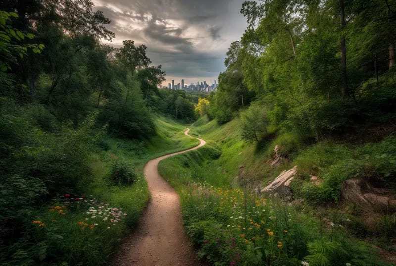
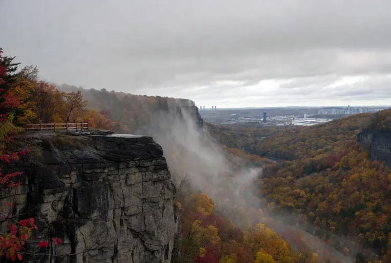
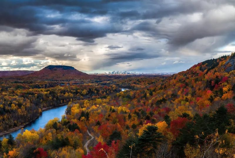
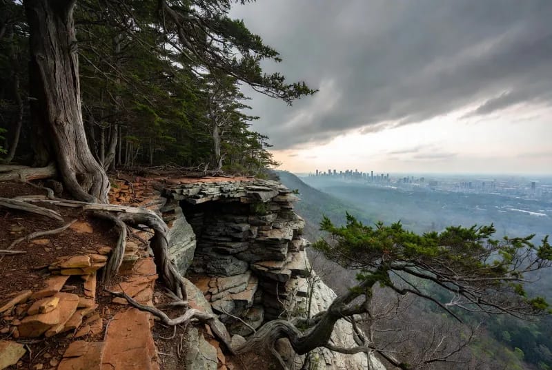
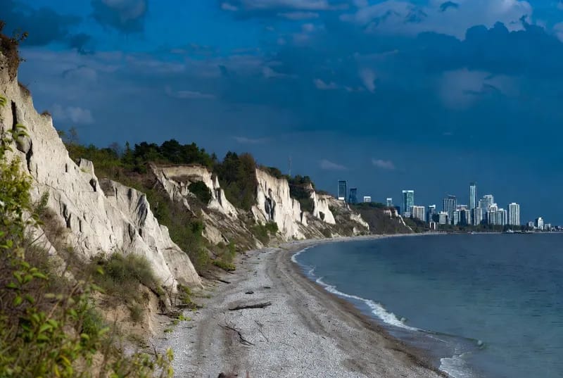
The Scarborough Bluffs Trail is the primary way to experience the dramatic, 90-metre-high sedimentary cliffs that define Toronto’s eastern shoreline. Formed over 12,000 years ago by glacial deposits, these towering, rugged escarpments create a landscape that feels worlds away from the city. The trail itself is a flat, 5 km coastal route that winds through Bluffer’s Park, taking you past a marina, open meadows, and a popular Blue Flag beach. While the geological history is fascinating, the vibe is pure recreation; expect a mix of families, joggers, and photographers. It is crucial to respect the environment here—the cliffs are unstable and prone to erosion, so stay strictly on the marked paths and never attempt to climb the face of the bluffs, as emergency rescues are unfortunately a recurring reality for those who ignore the warning signs. If you are planning a visit, timing is everything. On summer weekends, the parking lots fill up before 8:00 AM, and the area becomes incredibly congested. For a peaceful experience, aim for a weekday morning or visit during the shoulder seasons. There is no entry fee, but parking is paid and strictly enforced. If you are relying on public transit, be aware that the seasonal 175 bus only runs from May to October; otherwise, you face a long, steep walk down Brimley Road. Pack your own food and water, as options are limited to the seasonal restaurant at the marina. Bring a swimsuit if you plan to hit the beach, but keep in mind that only designated areas are lifeguard-supervised. It is a beautiful spot, but come prepared for the crowds and the elements.

No.7
Don Valley — Crothers Woods & Evergreen Brick Works
RecreationDon Valley

Don Valley — Crothers Woods & Evergreen Brick Works

Twenty minutes from downtown and you're on a forest trail where you can't see a single building — then you pop out at Brick Works for a flat white. Peak Toronto.

— Very Toronto Editors

A ravine trail network through one of the city's largest urban forests. The Crothers Woods loop is roughly 5 km of forested single-track with moderate elevation changes. Connects to Brick Works for post-hike coffee.

No.8
Cheltenham Badlands
RecreationCaledon (1 hr drive)

Cheltenham Badlands

It's a 45-minute walk at most, but seeing actual red-rock badlands an hour north of Toronto feels like a geographical glitch.

— Very Toronto Editors

A short but visually striking hike through Ontario's only exposed badlands — 450-million-year-old Queenston shale eroded into Mars-like red ridges. Two trails totalling 1.7 km, easy difficulty. Seasonal access May-November.